Barkas:Philippines adm location map.svg

Resolusi biasa (Berkas SVG, nominal 1.871 × 2.467 piksel, gedhené berkas: 719 KB)
Ringkesan
| Panyandra |
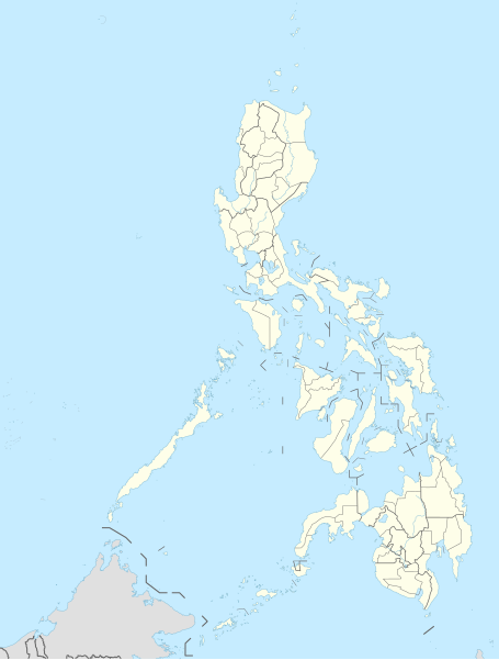
Deutsch: Positionskarte der Philippinen
English: Location map of the Philippines
|
||||||||||||
| Tanggal | |||||||||||||
| Sumber |
Own work using:
|
||||||||||||
| Juru pangarang | NordNordWest | ||||||||||||

|
This map has been made or improved in the German Kartenwerkstatt (Map Lab). You can propose maps to improve as well.
|
Jinis lisènsi
Usage of this file with:

explanatory notes: Legally binding is only the full legalcode. For a free usage I recommend to respect the following licence conditions:
1. Provide my name as given above: NordNordWest,
2. a copy of, or the URI for, the applicable license: https://creativecommons.org/licenses/by-sa/3.0/de/legalcode,
3. the title of the work,
4. in the case of an adaptation, a credit identifying the use of the work in the adaptation.
This license and the rights granted hereunder will terminate automatically upon any breach by you of the terms of this license. Any of the above conditions can be waived if you get permission from the copyright holder. If you have questions or wish differing conditions, please contact me through nnwest or my discussion page ![]() t-online.de
t-online.de
- Kowé kena:
- ngedum – nyalin, nyebar, lan ngirim karya
- nyampur – ngolah karya
- Sangisoré kahanan mangkéné:
- atribusi – Kowé kudu mènèhi krédhit kang patut, mènèhi pranala lisènsi, lan kandha yèn ana owah-owahan. Kowé bisa tumindak sasenengmu, nanging ora teges kang duwé lisènsi njurung lakumu.
- andum mèmper – Manawa kowé nyalin rupa, ngowahi, utawa nggawé karya nganggo bahan karya iki, kowé kudu mbabar karyamu kang wis dadi nganggo lisènsi kang padha utawa kang cocog karo karya asliné..

Sajarah kaca
Klik nang tanggal/wektu kanggo ndeleng berkas kiye nang wektu kuwe mau.
| Tanggal/Wektu | Miniatur (''thumbnail'') | Ukuran | Panganggo | Komentar | |
|---|---|---|---|---|---|
| siki | 30 November 2023 19.10 | | 1.871 × 2.467 (719 KB) | NordNordWest | corr |
| 30 November 2023 19.03 |  | 1.871 × 2.467 (719 KB) | NordNordWest | upd 2022 | |
| 13 Mei 2016 20.19 |  | 1.871 × 2.467 (719 KB) | NordNordWest | == {{int:filedesc}} == {{Information |Description= {{de|1=Positionskarte der Philippinen}} {{en|1=Location map of the Philippines}} {{Location map series N |stretching=103 |top=21.2 |bottom=4.3 |left=114.1 |right=127.3 }} |Source={{Own using}} * United... |
Pranala berkas
Ora ana kaca sing nyambung maring berkas kiye.
Panggunané barkas sajagat
Wiki liya ngisor iki nganggo barkas iki:
- Kanggo ing ceb.wikipedia.org
- Leyte (pulo)
- Sidlakang Samar
- Misamis Occidental
- Poro, Sugbo
- Ormoc
- Calbayog
- Tacloban
- Bontoc, Habagatang Leyte
- Padre Burgos, Habagatang Leyte
- Daram, Samar
- Maasin
- Salcedo, Sidlakang Samar
- Alcantara, Sugbo
- San Antonio, Amihanang Samar
- San Roque, Amihanang Samar
- Zumarraga, Samar
- Ajuy, Iloilo
- Tigbauan, Iloilo
- Mabini, Bohol
- Inabanga, Bohol
- Anda, Bohol
- Balamban, Sugbo
- Lazi, Siquijor
- Maria, Siquijor
- Siquijor, Siquijor
- Catmon, Sugbo
- Madridejos, Sugbo
- Tabogon, Sugbo
- Tabuelan, Sugbo
- Batanes
- Habagatang Upi
- Mapun
- Habagatang Ubian
- Turtle Islands, Tawi-Tawi
- Talakag, Bukidnon
- La Carlota
- Himamaylan
- Leon B. Postigo
- Jose Abad Santos, Davao Occidental
- Governor Generoso, Davao Oriental
- Dakbayan sa Iloilo
- Bantayan (pulo)
- Dakbayan sa Sugbo
- Malaybalay
Deleng naraguna liyané sadonya saka kaca iki.